Powered By Blogger

Sunday, 20 April 2014

Mitford Castle

The site of the castle is a strong one guarded by the Wansbeck ravine on one side and steep slopes on the others.  The castle has the honour of having the only five-sided keep in England. However, it is believed Mitford fords provided a better river crossing for travellers than nearby Morpeth, which is why it became of greater importance. The village was granted a charter for a market and became a borough some 50 years before Morpeth.


Prior to the 1066 Norman Conquest, the castle was held by Sir John de Mitford, whose only daughter and heiress, Sybilla Mitford, was given in marriage by William the Conqueror to the Norman knight, Richard Bertram. In 1215, it was seized by John de Balliol, King of Scotland’s troops.


A garrison commanded by Philip de Ulecotes withstood a siege here by Alexander II of Scotland in 1216. In 1264, the castle was held by the third Roger Bertram, but in that year, it was seized from him and committed to the custody of William de Valence, 1st Earl of Pembroke, King Henry’s   half-brother. It was held by Alexander de Balliol, the son of John de Balliol  and the elder brother of King John, in 1275. During the rebellion in Northumberland set in the 1310s, Sir Gilbert de Middleton seized Mitford Castle from the Valence family.

 
In 1315, it was the headquarters of a group of bandits responsible for kidnappings and the holding of prisoners to ransom led by Sir Gilbert de Middleton. The Castle was taken by a ruse by a band of men under the leadership of Sir William Felton and Sir Thomas Heton in December 1317 and the de Middleton brothers Gilbert and John were captured and later executed at London in Jan 1318. The Castle was then destroyed by 1327. There are conflicting accounts over the castle's destruction. One theory is of a fire during Middleton's rebellion. Another theory is that it was destroyed by the Scots in May 1318 during Middleton's imprisonment in the Tower of London.

 
It is said the ghosts of the Middleton’s still walk the ruins looking for their next kidnap victims and you can hear the howls of the porters who were slain by William De Felton whilst carrying ransom money at the gateway.

Monday, 14 April 2014

Dunstanburgh Castle

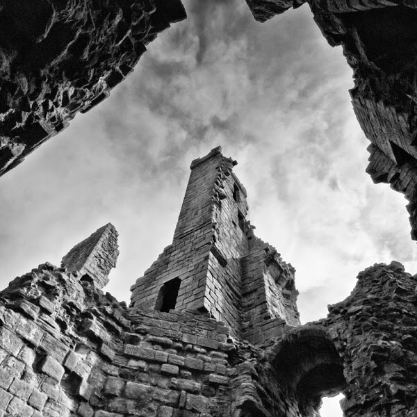
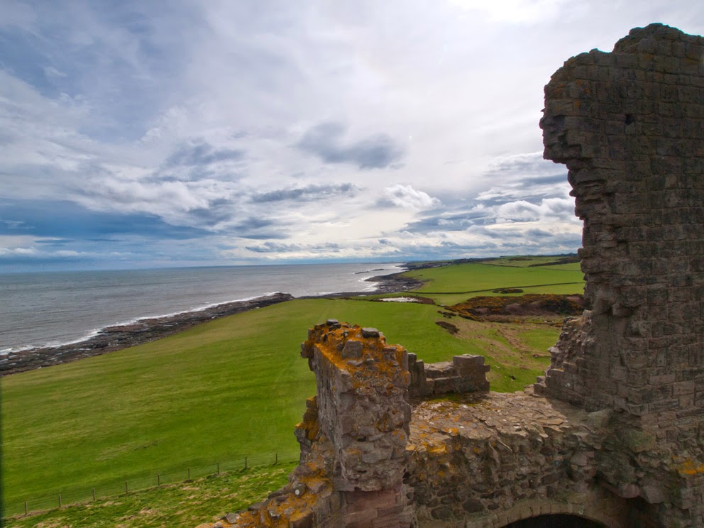
The building of Dunstanburgh Castle began in 1313 when Thomas, the Earl of Lancaster, nephew of King Edward II.   However Thomas never got to see the castle complete as he was executed in 1322 for his revolt, and defeat, at the battle of Boroughbridge.  The site of the castle provides excellent protection with its sheer cliff face on one side and the stormy North sea on the other. The site covered almost 11 acres and was, at that time, the largest castle in Northumberland.  An outstanding feature of the castle is its imposing Gatehouse of which the ruin still stands proud and tall.


In 1362, John of Gaunt, fourth son of Edward III, inherited the castle and had the gatehouse converted into a keep.  His son, Henry of Bolingbroke, inherited the castle in 1399 and subsequently usurped the throne as Henry IV.  Dunstanburgh became a royal castle and a Lancastrian stronghold during the War of the Roses.  Its Lancastrian commander was Sir Ralph Percy.


A castle as imposing as this has a history of hauntings.  One spirit that supposedly walks the grounds is that of Thomas, the first Earl.  It is said his beheading in Pontefract took 11 blows of the axe and his headless ghost wanders near to Lilburn Tower with the head tucked under its arm and a look of agony on its face.


Lilburn Tower is sometimes referred to as Queen Margaret’s Tower after Margaret of Anjou, wife of Henry VI.  She supposedly haunts the tower weeping for her soldiers defeated at the battle of Hexham and calling the name ‘Henry’.  This may be her husband who died in the Tower Of London in 1471 or her trusted friend, Henry Beaufort, Duke of Somerset, who was captured at the battle of Hexham and executed in the town square.  Another ghost was a Danish prince who fell in love with the Lord of the Castle’s daughter.  She was forbidden to marry him and one stormy night when he was riding to the castle he was set upon by her brothers and killed.  She was so distraught she threw her self from the ramparts to her death in the sea.  If you are lucky, or unlucky, on a stormy night you may catch a glimpse of a rider on a black horse riding furiously to the castle looking for his love.  If you visit the Gatehouse, watch out underfoot for toads, as they do love the wet slime on the walls and floor.

Tuesday, 8 April 2014

Chibburn Preceptory and St Andrews Chuch Hartburn, Northumberland.

Chibburn Preceptory  are the ruins of a Medieval/Post-Medieval Hospitaller preceptory. It was first recorded as a preceptory in 1313, and it was abolished in 1553 with the dissolution of the monasteries when all its lands were passed to the Crown and later the Widdrington family. The location of the Preceptory is on the pilgrims’ route to Lindisfarne. Low Chibburn had several uses, ranging from a hospital to a dowager house before being razed by the French naval hero, Jean Bart, who in 1691 landed at Druridge Bay, pillaging Widdrington village, castle and burning Chibburn.


The Knights Hospitallers of the Order of St John arose as a group of individuals who had founded a hospital in Jerusalem around 1023 to provide care for the poor, sick or injured pilgrims to the Holy Land. After the Western Christian, conquest of Jerusalem in 1099 during the first crusade the organisation became a religious and military order and it was charged with the care and defence of the Holy Land. To finance their exploits in the Holy Land the Knights Hospitallers received many gifts of land and estates in England to be worked to generate revenue. It was one of several military orders of which The Knights Templar are another. This order was disbanded in 1312. On the suppression of the Templars in 1308, efforts were made by the Hospitallers to get themselves declared heirs to the Templar possessions, their claim being supported by the pope. Chibburn Preceptory was, it would appear, an original possession of the Hospitallers.


The Preceptory of the Knights of St John was defended by a moat enclosing an area circa 100 yards diameter. The buildings formed a parallelogram having a courtyard in the middle, a dwelling house on the west, a chapel occupying the entire south side and various offices on the north and east sides. In the chapel; human bones have been found and a grave slab forms the threshold of the door leading from courtyard into a stable. The upper portion of a stone coffin is in one of the windows. The walls of the chapel are of excellent workmanship, and represent the sole remains of the Preceptory of the Knights of St John. The chapel was used as a pillbox during the Second World War.


St Andrews Church, Hartburn

The church shelters near to the east end of the small village of Hartburn.  At one time, the church belonged to the Tynemouth Abbey, later transferring to St Albans and after the dissolution of the Monasteries; it passed to ‘lay rectors’.  One such rector was the Earl of Derwentwater until his execution after the 1715 Jacobite rebellion.


The tower is mainly late 12th / early 13th Century with traces of its Saxon heritage.  Into the east, side of its doorway there has been a Maltese cross and two daggers incised into the stonework giving rise to speculation that the Knights Hospitaller or Knights Templar passed this way.


 The chancel is 13th Century with decorative pillars.  The pillar nearest to the pulpit shows a fish.  The fish is an ancient Christian symbol, predating the cross as a sign used by early Christians.  It is believed it was a secret symbol adopted by the early Christians, which would not draw attention to them at a time when the church was suffering persecution.


As you enter the church, you are faced with a money chest that Oliver Cromwell is said to have used to transport his wealth.  There are two substantial 13th Century coffins and a 12th Century baptismal font.  There is a plaque in the memory of the Revd John Hodgson, a famous historian of Northumberland who was vicar of Hartburn from 1833 to 1845.


Friday, 14 March 2014

Edlingham Castle


Edlingham Castle doesn’t follow the normal trend of being situated on a good defensive foundation as it lies at the bottom of a valley between Alnwick and Rothbury. 

 
The Bleak Northumberland Landscape


By 1174, John de Edlingham built a two storey Hall House in a moated enclosure in the mid thirteenth century.. In 1296 the property was taken over by William de Felton who added a palisade and a gatehouse, fortifying the main hall and adding other buildings inside the courtyard


In 1298 William de Felton built a hall house with a three storey residential tower.  In 1396 Elizabeth de Felton inherited it, marrying Sir Edmund Hastings, who added a strong solar tower. Their descendants occupied the castle and estate until 1514; it was then it was purchased by George Swinburne; a constable of Prudhoe, whose family held it until the 18th century. 


The hall is the earliest standing structure at Edlingham. This dates from the period 1295-1300. It almost certainly had vaulted cellars topped by a great hall, or living area. The hall was rectangular, with an octagonal turret at each corner.  The tower house is now nearly free-standing, though it was originally connected to the hall by a passage.  The highlight still remains the 15th Century solar tower.

Friday, 7 March 2014

Warkworth Castle


 Before the Norman conquest, it is believed there was a stronghold, built by Ceolwulph, a Northumbrian King.  In 1158 Henry II bestowed the manor upon Roger Fitz-Richard, the ancestor of the Clavering family.  Roger set about fortifying the property and built a castle.  In 1173 William the Lion crossed the border to support his claim for possession  of Northumberland as part of the Scottish kingdom and the castle was destroyed.  However it was quickly rebuilt and in the reign of Edward II, the manor of Warkworth, and the castle, reverted to the Crown.  Eventually it became the principle seat of the second Lord Percy of Alnwick.


Castle Gates

In 1403 an attempt was made to raise the north in rebellion against the king and the Earl of Northumberland was a leading player.  The Earl went to meet the king and was promptly put into prison and the castle along with Prudhoe and Alnwick castles reverted back to the king.  The Earl was later set free but again chanced his luck at rebellion.  The king marched into Northumberland and the Earl fled north of the border leaving his castles behind.

John of Lancaster, son of the king, was made Warden of the East March and took up residence at Warkworth.  In 1462 Edward IV granted the residence to his brother, George, Duke of Clarence and in 1463 was besieged by Sir Ralph Grey.  Under Henry VII, the manor came back to the Percies and has remained since.
Castle Keep


The Lion Tower
 
In 1569 The Earl of Northumberland joined in a rebellion caused by changes of the Reformation.  The rebellion proved a failure and the Earl took off for north of the border.  Sir John Forster took possession of the castle.

The Lion Tower


The last Percy earl died in 1670. In the mid-18th century the castle found its way into the hands of Hugh Smithson, who married the indirect Percy heiress. He adopted the name "Percy" and founded the dynasty of the Dukes of Northumberland, through whom possession of the castle descended.

In the late 19th century, the dukes refurbished Warkworth Castle and Anthony Salvin was commissioned to restore the keep. Alan Percy, 8th Duke of Northumberland gave custody of the castle to the Office of Works in 1922. Since 1984 English Heritage  has cared for the site, which is a Grade I listed building.


The Great Hall

Entrance to the Lion Tower


The Chapel inside the Keep


Warkworth castle is also famous for starring in one or two passages from Shakespear’s “King Henry IV”

Wednesday, 5 February 2014

Aviemore, Scotland.


Aviemore is a town and tourist resort, situated within the Cairngorms National Park in the Highlands of Scotland. The town is popular for skiing and other winter sports, and for hill-walking in the Cairngorm Mountains.


CAIRNGORMS


Aviemore has been in existence since the 1600s, the quiet growth of this historic village of Aviemore began in the 1800s with the advent of the railways, when it functioned as a small junction on the old Highland Railway. It is situated on the plain overlooked by the Monadhliath and Cairngorm Mountains. With the advent of the rail, travel inevitably became easier in this previously inaccessible area of Scotland. Aviemores’ popularity as a holiday destination grew, especially with Queen Victoria who visited regularly, enjoying the nearby spa village of Grantown-on-Spey
Loch an Eilen


Castle on Loch an Eilen

 
Loch Morlich
Carn Lochan na Bienne


The awesome Cairngorms beckoned to the intrepid explorers, climbers and geologists of the time, many of whom were already hardy visitors to Aviemore, seeking a challenge and the truth of existence. In the 1800s many of these geologists combed the Cairngorm Mountain range searching for the cairngorm semi-precious stone, a wonderful pale gold or amber in colour,

 
Storm Clouds over Loch Morlich

The village began to grow as a result of it becoming a railway junction in 1898, following which the Highland Railway became a major constructing housing for its staff and the Aviemore Hotel. Aviemore became one of the first skiing resorts to be established in Scotland with the opening of the chairlift in 1961 and is also notable for being near the freely grazing reindeer herd at Glen More, the only one in the United Kingdom.  The resort has since grown into Britain's most visited ski resort during the winter months.


Sunday, 26 January 2014

Amble


Amble was originally located well to the south of the mouth of the River Coquet, however in March 1764, the river below Warkworth changed its course due to heavy rain. The river sought its most direct route to the sea and broke its banks across a broad meander and as a consequence Amble found itself less than one third of a mile from the new river mouth.
In 1204 the spelling used was Ambell’ and by 1610 it was Anbell’. However by 1769 The modern name of Amble was being used. The name Amble is generally accepted to mean ‘Anna’s Bill’ or ‘Anna’s Promontory’.  For a short time in the 1980’s Amble was officially known as Amble-by-the-Sea, however this was dropped in 1985 and the town reverted back to being called Amble.


Amble owes much of its growth and early prosperity to the 19th century coalfields from which it used to ship coal to southern England and the Continent. As collieries were opened; Amble’s location at the mouth of the River Coquet, and its railway links to the Northumberland coalfields, made it a centre for the transportation and export of coal.  Prior to this development the town was little more than a hamlet. The principle local mineworkings were those at Broomhill  and at Radcliffe. Today, the collieries in Northumberland are all closed (the last, Ellington, closed in 2005), and the railway no longer serves Amble.
Other industries, such as ship building and repair, and sea fishing, expanded with the growth of the town, although traditional Northumbrian fishing vessels such as cobles have sheltered in the natural harbour here for many centuries previously.
To the north of the town, along the riverside land known as The Braid was originally the site of a shipyard. Boat building began in Amble at the end of the 18th century when the ‘Chevington Oak’ was built with wood from nearby Chevington Woods. There was also a joinery yard and sawmill on the Braid on the site where the Marina Arms now stands.


The harbour had a brickworks, boatyards, and an extensive network of high-level railway lines serving timber coal staithes around the harbour at the Radcliffe and Broomhill Quays. The town’s railway station was built in 1878 and was approached by a sloping ramp from Church Street.In the 1930s, when the RMS Mauretania was heading on her last voyage to the breaker's yard at Rosyth, the town council of Amble sent a telegram to the ship saying "still the finest ship on the seas". The Mauretania replied with greetings "to the last and kindliest port in England"


Today, Amble is Northumberland's most important fishing centre north of the River Tyne. The fishing industry survives, although it has reduced numbers of vessels now, as does a small marine industry - mainly concentrated around the construction and repair of yachts and other pleasure craft. Leisure sailing has also become important and, as well as the marina, the town has a vibrant yacht and boat club. A small industrial estate is located to the southwest of the town, whose clients include food processing plants, vehicle repairs and telecommunications companies. Amble also has a number of good shops including Tesco and Boots, gift shops, and many pubs and fast food outlets. Tourism now forms an important sector of Amble’s economy. Part of the harbour was redeveloped into a marina with secure berths for 250 vessels which opened in 1987. The outer boundary of the marina incorporates one of the original timber jetties from the early harbour as part of the old river bed was reclaimed during construction.