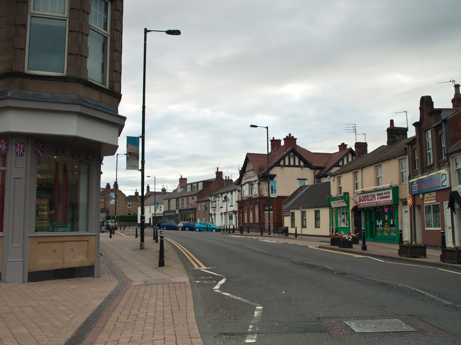
Powered By Blogger

Friday 7 December 2012

Places

                ALNMOUTH, NORTHUMBERLAND
 
 
                                                        BROOKLYN BRIDGE, NEW YORK
 
 
AMBLE, NORTHUMBERLAND
 
 
                                 FLORENCE, ITALY
 
 
RONDO, ANDALUCIA, SPAIN
 
 
                                                                GIBRALTER
 
 
PARIS, FRANCE
 
 
HEAVENFIELD, NORTHUMBERLAND
 

Wednesday 28 November 2012

A Selection of Landscapes

                          Alnwick Moor - Northumberland


                                                                    Loch Etive - Scotland
 

Milli Gorge - Crete

                        Windy Ghyll - Northumberland
 
                                                           The Cheviots - Northumberland
 
 
Scottish Highlands
 
                                                                Glencoe Valley - Scotland
 

                                      Andalucia - Spain

                                                     Simonside Hills - Northumberland


Saturday 3 November 2012

Wooler and Humbleton Hill


This walk starts in the attractive stone-built Market Town of Wooler in Northumberland, perched high above the Wooler Water in the foothills of the Cheviots, and is a natural gateway to Glendale and Northumberland National Park.  The walk takes us upto Wooler Common, then west following St Cuthberts Way to as far as Gains Law, then back passing Humbleton Hill and the village of Humbleton until reaching Wooler.  Altogether the walk is approximately 6.5 miles with a few hilly stretches.

 The name Wooler may be from Old English wella "well, spring" and ofer (ridge or hill). A record of the name as Welnfver in 1186 seems to suggest this origin. The other origin may be "Wulfa's hillside", from the Old English personal name Wulfa "wolf" and őra "hillside, slope", although this word in place-names usually means "river mouth, shore". In 1232 it is recorded as Wulloir.

Up to the beginning of 12th century Northumberland was ruled by a succession of earls first, Anglo-Saxon, then Danish and eventually Norman. However there is no reference to Wooler in the Domesday Book (1086) due to the area still not being totally under William the Conqueror’s control.

On the invasion route of English and Scottish armies and situated so close to the border Wooler viewed many great events of history. The battles at Humbledon Hill (Homeldown) in 1402 and Flodden in 1513 although great in historic terms had perhaps less effect than the Scottish raids of 1340 & 1409 which caused great destruction. Wooler was garrisoned at various times by both nations. The 'reivers' or border raider were a fact of life in the border marches for several centuries as evidenced by the numbers of Peel Towers and fortified farm houses through out the borders.

One of the reasons for the success of Wooler is that it lies on an important route (turnpiked in the 18th century) across the Borders (the present A697) between Morpeth to the south-east, and Coldstream to the north-west – ultimately a route between London and Edinburgh. It meant that over the later 18th and early 19th centuries, the town provided the important function of post or coaching stop.


As you start to leve Wooler town and head for the common you can follow in the footsteps of Saint Cuthbert, who became one of the more famous Northumbrians.  Saint Cuthbert (c. 634 – 20 March 687) was an Anglo Saxon monk, bishop and hermit, associated with the monasteries of Melrose and Lindisfarne in the Kingdom of Northumbria. After his death he became one of the most important medieval saints of England, with a cult centred at Durham Cathedral. Cuthbert is regarded as the patron saint of northern England.


Hart Heugh Hill


Kenterdale Hill and St Cuthberts Way
 
                                                                                 Wooler Common


St Cuthberts Way


The Last Post
How does a Parcel delivery van end up in the hills?
 

Yeavering Bell and Newton Tors from Gains Law


Fredden Hill and Newton Tors from Gains Law
 
 
The Battle of Humbleton Hill (or Homildon Hill) was a conflict between the English and Scottish armies on September 14, 1402 in Northumberland, England, The battle was recounted in Shakespear’s Henry IV, part 1.


The approach to Humbleton Hill (on the right)
 
 
On 22 June 1402, a small government backed Scots force, returning from a raid, was beaten by George Dunbar, the Earl of March’s son, at the battle of Nesbit Moor, for which no quarter was given.

 
View from Gains Law to Humbleton Hill
 
Archibald Douglas, 4th Earl of Douglas arguably the most militarily powerful man in Scotland, and a key part of the Duke of Albany’s administration, used the pretext of Nisbet Muir to lead a punitive expedition into England. With Murcoch of Fife, Albany's son, Douglas's army marched as far as Newcastle to avenge the battle. At the head of 10,000 men he laid waste to the whole of Northumberland.

March persuaded Henry Percy, 1st earl of Northumberland, and his son Harry “Hotspur” to lie in wait for the returning Scots at Wooler. Once Douglas's men had made camp at Millfield, relatively low ground, the English army rushed to attack. The Scots did however have keen sentries and the army was able to retreat to the higher ground of Homildon hill, and organised into traditional Schiltron formations. Douglas had not learnt the lessons that had defeated his great uncle at the Battle of Hallidon Hill seventy years previously. The Schiltrons presented a large target for the English Longbowmen, and the formations started to break. A hundred men, under Sir John Swinton chose to charge the enemy saying: "Better to die in the mellay than be shot down like deer". All perished. It has been suggested that Douglas hesitated to signal the advance of his main force, and when he did, it was too little too late. Douglas's mauled army met the as yet unbloodied English men at arms, and were routed. Many of Douglas's leading captains were captured, including his kinsman George Douglas, 1st Earl of Angus, Thomas Dunbar, 5th Earl of Moray and Murdoch of Fife. Douglas himself was captured having been wounded five times, including the loss of an eye. This wounding was despite the fact that it is alleged Douglas' armour had taken three years in its construction.

 
The Path back to Humbleton Village
 

Humbleton Village and the road back to Wooler


Thursday 6 September 2012

Wedders Leap to Windy Ghyll


This walk starts at Wedders Leap car park situated next to Barrowburn, it’s a circular route taking you onto the Border Ridge between Scotland and England, leading onto Windy Ghyll then back to Wedders Leap.  The whole route is approximately 10 miles.

                                                               Wedders Leap 
From 1181 to 1536 the monks of Newminster Abbey owned the lands known as Kidland which lie to the north of Coquet as far as the border.  As you take the road passed Alwinton and follow it on you eventually come to a car park at Wedders Leap next to Barrowburn.  Wedders Leap derives its name from the latter days of the Border Reviers when thieving and pillaging was the normal pastime for any self respecting rogue.  On one particular night a thieving scoundrel stole a wedder (castrated ram) from the flock grazing on Shillhope Law.  He put the wedder around his neck and carried it off.  However it didn’t take the owner and his men long to realise what was happening and proceeded to give chase.  The scoundrel got this far when he had no option but to leap the deep river with the wedder still across his shoulders.  He made it as far as the opposite bank then fell backwards into a watery grave pulled down by the bulk of the wedder.  The pool at this point is about fourteen feet deep.

There are two paths at Barrowburn which will take you north to the Border Ridge.  The one I took follows the hillside past Kyloe Shin  which has fantastic views of the valley.


As you progress along the hillside you enter a large forest area and the path skirts a small house at Fairhaugh by Usway Burn.

                                                                       Fairhaugh

The path continues up through the forest at a steep incline and eventually makes its way through another small valet to a point where several paths coincide.


At this point pick the path which takes you upto Little Ward Law at approx 495 m (above sea level).  The view back through the valley is quite spectacular.

                                                   The view from Little Ward Law
 

The path descends from Little ward law down to a small gully known as Scotchman’s Ford then up to Windy Ghyll on the Border Ridge at 619 m.

                                            View towards Scotland from Windy Ghyll


The panoramic view from Windy Ghyll has  to be seen to be believed with hills rolling into the distance.  However care must be taken with the peat bogs which could suck you down to a grisley end.  On the summit there is a large cairn which marks the spot of the slaying of Lord Francis Russell at a meeting of the Wardens of the Marches in 1585.  The Wardens from both sides of the border would meet with their retinues and set up a form of court in this lawless area.  Generally neighbours would complain of cattle rustling, feeding rights and numerous other ills.  At this particular time the English warden was Sir John Foster who came to meet his Scottish counterpart Sir Thomas Kerr of Ferniehurst.  After general business started there was a scuffle amongst men of both side and a shot rang out.  Sir Francis Russell, son inlaw to Sir John lay slain.  It took the efforts of both Sir John and Sir Thomas to stop a battle and bloodbath occurring.  A couple of days later Sir John wrote a letter outlining what happened and referred to the incident being an accident.  However two days later he wrote another letter, countersigned by 32 Northumbrian lords, stating the Scots rode to the meeting in battle formation with he intent of making a feud and resulting in the death of an English nobleman.  Queen Elizabeth 1st  preferred the second letter as it suited her purposes that the catholic sympathising Sir Thomas killed an English nobleman.  This now became an international incident and helped Queen Elizabeth discourage James IV from falling in league with factions which would led to Scotland being  a backdoor for French Catholism.  The next time you pass Windy Ghyll take a moment to savour not just the scenery but the historical and medieval politics that centred on this bleak spot, where a scuffle became a religious international incident. 


           View from Windy Ghyll with The Cairn marking the death of Sir Francis Russell


Continue west along the border ridge for about a mile and the path will turn south by Plea Knowe and this path is known as The Street which an old drover road running from the border ridge to Barrowburn.  Some of the scenery along the Street includes the Black Braes, Swineside Law, down to The Slime and Hindside Knowe. 


The path eventually meets the roadside and it is a short walk to Barrowburn and a welcoming Tea Shop.  After setting off, suitable refreshed, it is another short walk back to Wedders Leap and an opportunity to take off your boots and collapse on the grass.  If you like sheep, cows, the occasional bull and thousands of midges then this is the walk for you.  If you do make Windy Ghyll take a moment to close your eyes and remember Sir Francis Russell, Sir John Foster, Sir Thomas Kerr and the historical importance of these wild and desolate hills of the Cheviots.


Friday 17 August 2012

Newbiggin by the Sea, Northumberland


The earliest recorded spelling of the name Newbiggin is dated 1187 and is Niwebiginga which in Old English means ‘new building or house’.   

In 1240 the village was in the hands of John Baliol, Regent of Scotland and founder of Baliol College, Oxford.  The estates passed to King Edward 1st after John was forced to abdicate in 1295, then they passed onto John Dreux, Earl of Richmond.  However it would appear that the estates were largely managed by appointed bailiffs and freeholders who enjoyed full rights for cattle grazing.  The Crown again acquired ownership then passed it onto John de Denton of Newcastle followed by the Widdrington family.  However after the Widdrington’s backed the wrong side in the Jackobite Rising of 1715 it again passed back to the Crown. 

One of the more noticeable buildings in the village is St Bartholomew’s church situated on a barren treeless promontory known as the ‘Point’.  The church dates back to early 13th Century with the addition of a spire in the 14th Century.  It later undertook a rescue and remodelling package in the 19th Century.  The position of the church on the ‘Point’ means it is of greater benefit to mariners and fishermen than to its followers.  It is believed a smaller church occupied this site before 1174.


                                            St Bartholomew's on Church Point
The passage of time saw the expansion of the village and the development of the port facilities for the export of grain and grindstones (it was rumoured that it was third in importance after London and Hull).  However in the early 19th Century this industry was overtaken by Newbiggin’s oldest and most notable industry – fishing.  The local fleet expanded to accommodate large herring boats as well as shallow draft cobles (fishing boats).  Amongst the fishing cottages there can be found the Lifeboat House 1851 (oldest working lifeboat house in the country), sheds, cobles, sea tractors and the Herring House (for coopering, barrelling and kippering).  The drive to build the Lifeboat house came from the tragic loss of 10 young fishermen from 4 boats in March 1851 when a storm suddenly arose.  The lifeboats were regularly hauled by the women folk in support of the men.  In 1940 during the rescue of the Eminent the lifeboat was launched, landed and relaunched at the other side of the Point having being dragged by 60 men and women through wind and snow.


                                                                                                               Fishing cobles

        Sea tractor for pulling boats ashore  

During the Edwardian and Victorian periods the village became a much sought after beach resort for the middle and working classes of Tyneside and South East Northumberland, attracting hundreds of visitors per day during the summer months.  A new gas works was opened in 1865 followed by a fully functioning railway station in 1870.  In 1862, The Haven, a large summer residence was built with views over the sea for a member of the Trevelyan family from Wallington, the house subsequently became the Newbiggin colliery managers home.  Other houses overlooking the sea were summer homes for rich business people and ship owners from Tyneside.  1,3 and 5 Front Street are said to be the oldest properties in the village which prior to 1850 housed the Johnson and Company brewery.

                                                The Bandstand on the Piazza
In 1868 the first telegraph cable from Scandanavia came ashore at the Point.  Cables were floated on tar barrels, towed ashore by longboats, pulled up the beach by horses then placed in trenches cut by fishermen, terminating at the Cable House.


The Promenade and Piazza
In 1908 Newbiggin colliery was sunk and did not close until 1967, at its peak it employed 1400 men.  The first manager came from Durham and, it appears, quite a number of Durham folk made their homes in Newbiggin shortly afterwards.  41 men have lost their lives in this pit.  However, this did not detract from the tourist industry, as a promenade, bandstand and bathing shelters were built between 1929 and 1932.  The promenade was opened by Sir Charles Trevelyan in May 2932.  Visitors came by bus and train to enjoy trips around the bay, the Pierot shows and other entertainment.  The faded glory of bank holidays in Newbiggin is still maintained with Bertorelli’s 1930’s period Café Riviera and the Coble Public House.

                                                             
                                                                 Front Street
Storms, extreme sea erosion and collapsed mine workings destroyed the sea front and led to flooding of the village.  In 1993 a sea wall improvement scheme was introduced which included the refurbishment of the bandstand and development of a piazza.  In 2007 the beach was recharged by importing 500,000 tonnes of sand from Skegness and deposited on the beach through a 1m diameter pipe.  Breakwaters were installed and a brass statue by sculpture Sean Henry named Couple, is anchored at the centre of the bay.


Map of Newbiggin by the Sea

Additional Reading:


Tuesday 14 August 2012

Alnmouth

Alnmouth has a long and varied history with evidence of nearby early bronze age activity.  The river Aln was marked on a map by the geographer Ptolemy which dates back to AD 150, suggesting an interest by Romans cartographers who mapped the coastline and rivers.


Adtwifydri or Adtuifydri (‘at the two fords’) is the name used by the Venerable Bede to describe the meeting of river and tributary at the mouth of the river Aln.  It is also the probable site of a great synod in 684 AD in which St Cuthbert was chosen as the Bishop of Lindisfarne.


In about 1152 a Norman knight – William de Vesci was given permission to hold court at Alnmouth, which raised the importance of the locality and a new town was started.  During the medieval period the town thrived on the exporting of stone, grain, wool, sheepskin and leather, and became quite prosperous.

However, in 1314 the English were defeated by the Scots at the battle of Banockburn.  Later, in about 1336, Alnmouth was raided, which together with the subsequent effects of the Plague in 1348 saw a general decline in economic activity and labour shortages.

The 16th Century saw the rise of the Border Reivers across Northumberland and the Scottish Lowlands and the corresponding increase in lawlessness throughout the area.  Economic prosperity continued at low levels until 1603 with the Union of the Crowns of England and Scotland.  By the 18th Century Alnmouth was prominent for grain exports and importing goods from London.  Many new granaries were built to accommodate the rise in industrial activity.

To the south of the river estuary is Church hill which has an Anglo Saxon cross and was the probable site of an Anglo Saxon church.  The river Aln always flowed to the south of Church hill which was joined to the main township by a low lying piece of land.  On Christmas Day 1806 a huge storm caused the river to breach the land and changed its course directly into the sea, leaving the estuary to fill with silt. 


As ships became bigger and built of iron and steel, they became harder to dock in the tricky harbour conditions and this again led to a decline in the towns prosperity.  Now the granaries have been converted into houses and Alnmouth has embraced tourism as the ‘new’ industry with its picture postcard pastel cottages and red painted 18 century roofs.


Map of Alnmouth